- Home
- Boat Fishing
- Nautical Charts
Using Nautical Charts and Tide Tables to Plan for Boat Fishing
Nautical Charts are fundamental to boat fishing safety. If you're going fishing in a boat you need to have one aboard for your area, and be fully conversant with its use.
Apart from the safety angle, the information on them makes them invaluable to boat anglers like us.
Before you cast off for a day's boat fishing, you'll have asked yourself two fundamental questions...
1. Where should I go?
2. When's the best time to be there?
Let's take a look at these in turn ...
Where should I Go Fishing?
Let's imagine this is a completely new boat fishing venue for you. You know nothing about the place, and have no-one to advise you as to where the good marks are. Where do you start? Easy! First, a friendly chat with the blokes in the tackle shop - followed by a close study of the chart for the area.
Find those Boat Fishing Hotspots by using Nautical Charts!
There are two ways of going about this:~
- You may have a specific species in mind, in which case you'll be looking on the nautical chart for indications of its likely habitat. You fancy a spot of boat fishing for turbot maybe, so you'll be looking for a sandy or shingle bank with a decent run of tide over it.
First though, you'll need some fresh bait. Best spots for mackerel? Ah yes, there's an outfall pipe off the beach. But if that doesn't appeal, you should be able to pick up a few along the edge of the tidestream off that headland.
- Alternatively, your attention may be drawn to a specific feature on the nautical chart and you think - Hmm, it's June, that mark's just got to hold Black Bream - and set out to fish accordingly.
Whichever way you approach it, the nautical chart is an essential boat fishing resource and absolutely vital for safe navigation.
The best nautical charts in my view (although I accept may be a little prejudiced here) are Admiralty Charts as produced by the United Kingdom Hydrographic Office. These cover all of the world's oceans in detail, so wherever you fish there'll be one for you.
If you use the full scale marine charts, then you'll also need a copy of Chart 5011 - 'Symbols and Abbreviations Used on Admiralty Charts' - which isn't a chart at all, but a booklet. This will enable you to interpret all the information given symbolically on the nautical charts.
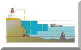
Now you can find where tide rips and races occur (great for bass, but no place for a novice boat skipper), eddies, wrecks, areas of broken ground, sand banks, underwater rocks and drop-offs etc, etc.
Vital information? You bet!
These nautical charts are intended for use on merchant and naval vessels, not small fishing boats, so they're large - around 720mm by 1060mm. But in recent years the Hydrographic Office has recognised the needs of small-boat skippers and now provides the 'Leisure Editions'. There are three versions of these, all of which contain the same level of detail as shown on the full size charts:~
- Small Craft Editions ~ These are full-size charts, printed on High Wet Strength paper that won't fall apart when it get's a bit wet, and folded to about the size of an Ordnance Survey Map.
- Leisure Chart Folios ~ These are the ones we use aboard our sailboat 'Alacazam'. They're not folded, but are a handy A5 size (590mm x 420mm)- ideal for those boats that have a chart table, are printed on heavyweight chart paper and are packaged in a clear-view plastic wallet.
- Tough Charts ~ If you fish in an open boat or use your charts in the cockpit, look no further. These are the ones for you!
Coverage for the UK based boat angler is extensive including most areas of UK coastline, from the Irish Sea and Bristol Channel, up to Liverpool, Holyhead and the Firth of Clyde, and back down to the Solent, the South Coast of Devon and Cornwall, the Isles of Scilly, Jersey and Guernsey.
Coverage also stretches as far as the north coast of France to include Normandy, Calais and the English Channel.
There are over 140 different charts - one or more of them will be right for your boat fishing venue.
UK coverage is almost as extensive as the Small Craft Editions (and expanding), but also includes folios for the Mediterranean and the Caribbean.
They're produced as a pack of around 20 or so A3 size (420mm x 497mm) charts covering a specific area, and are spirally bound for convenience - and are fully waterproof!
Whichever version you go for, I predict you'll spend hours pouring over the chart, searching out that boat fishing hotspot - which of course, you'll want to keep to yourself.
Buy these Charts for Your Fishing Area Here!
And the Best Time to be There?
Just like people, fish have their active times and their rest times. Unlike people, most of whom are active during the day and rest at night, fish plan their life around tides. So understanding tides clearly helps you know when to fish.
But Don't Forget Navigation & Seamanship...
All this talk about fishing from a boat, nautical charts and tidal information leads naturally to navigation and seamanship.
The sea can be a treacherous mistress and makes no allowances for beginners. Whilst it isn't within the scope of this website to get into this topic, I must stress the importance of taking it very seriously indeed.
So if you're a fishing boat skipper and haven't yet done so, please at least get a good book on the subject - the one illustrated here takes some beating.
Apart from any personal considerations, you owe it to your crew.
Recent Articles
-
Sea Fishing Rods and Reels Must Be Compatible for a Balanced Outfit
Mar 08, 21 08:30 AM
A quality reel fitted to a quality rod doesn't necessarily make it a quality outfit. Your fishing rods and reels have to be properly matched if you're to get the best out of them, and here’s how -
Essential Lure Fishing Tips That All Saltwater Anglers Should Know
Mar 08, 21 04:51 AM
Which single lure fishing tip applies to trolling, jigging, baitcasting, spinning, fly fishing and any other branch of lure fishing? Well, it is the one at the top of this list -
Vital Jig Fishing Tips That You Really Cannot Afford To Miss!
Mar 07, 21 10:20 AM
Essential jig fishing tips to help you select the right lure for successful jig fishing, together with the techniques required to get the most out of your jig fishing outfit


New! Comments
Have your say about what you've just read! Leave me a comment in the box below.